Geovez Enterprise
Geovez Enterprise is KDRM’s enterprise geospatial product suite. It combines an ArcGIS-compatible service and API layer with a high-performance web mapping application stack, administrative tooling, and a modern rendering engine for organisations that need strong integration flexibility, operational performance, and long-term control of their platform architecture.
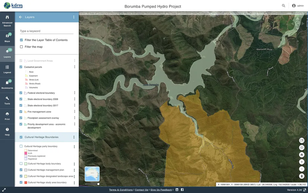
The screenshot above shows Geovez Map Viewer in an operational utility context. The wider Geovez Enterprise offering is not a single application; it is a suite of products that can be deployed together or selectively, depending on the client’s architecture, security model, operational workflows, and delivery priorities.
The Geovez Enterprise suite
Geovez Server
Geovez Server is the enterprise geospatial service and API platform. It provides ArcGIS-compatible REST endpoints, Feature Service patterns, Mapbox Vector Tile endpoints, token and sharing behaviours, and flexible import and export pathways for loading, transforming, publishing, and exchanging geospatial data across enterprise systems and open spatial formats. It is built around modern API and data-service patterns, including FastAPI, PostgreSQL/PostGIS, standards-based identity, and AWS-oriented deployment.
Geovez Portal
Geovez Portal is the management layer for users, content, web maps, integration configuration, and related Geovez Enterprise administration. It gives teams a structured environment for managing access, configuration, and operational geospatial content.
Geovez Map Viewer
Geovez Map Viewer is the high-performance web application layer. It integrates with ArcGIS Online and Portal for ArcGIS, consumes Geovez Enterprise services, and supports access to 2D web maps and 3D web scenes based on user permissions.
Geovez Map Engine
Geovez Map Engine is KDRM’s modern web mapping API, built around WebGPU rather than older WebGL-only approaches. It was built from scratch by KDRM to support better rendering performance, memory handling, and 2D/3D visualisation, and it is being prepared as the primary rendering engine across the Geovez platform.
Geovez Mobile
Geovez Mobile extends the platform into connected and offline field environments for iPhone and Android. It is designed to support high-performance mobile mapping, field data capture and editing, offline workflows, and synchronisation back to Geovez Enterprise when connectivity is restored. Geovez Mobile is still in development.
Designed to fit natively with AWS
Geovez Enterprise was engineered to fit natively within AWS cloud-native environments rather than being layered on top like traditional enterprise GIS. This native approach delivers meaningful performance and security benefits. For suitable workloads, the platform aligns naturally with PostgreSQL/PostGIS/Aurora-oriented data services, object storage, caching, cloud networking, modern identity, automated deployment, and API-driven integration.
For clients using AWS, this allows performance tuning and operational design to focus directly on the API layer, SQL/PostGIS queries, caching, containers, and supporting AWS infrastructure, instead of forcing every workload through a heavier traditional map-server runtime. The result is a lighter service and API architecture with strong integration flexibility, clearer operational transparency, and better long-term maintainability.
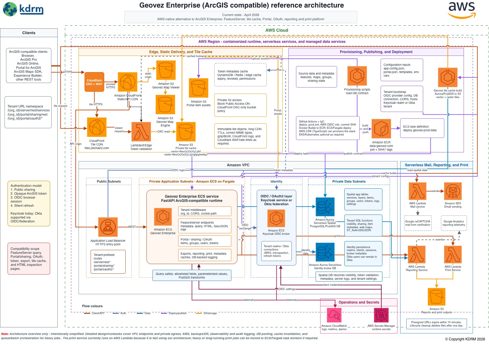
Geovez Enterprise is designed to work alongside ArcGIS components where they are the right fit. In practice, that means organisations can use ArcGIS Pro to access and edit secure and non-secure feature services coming directly from Geovez Server, while using Geovez Enterprise as a lighter, source-code-accessible, AWS-aligned service and integration layer.