Web Services / API Development and Workflow Automation
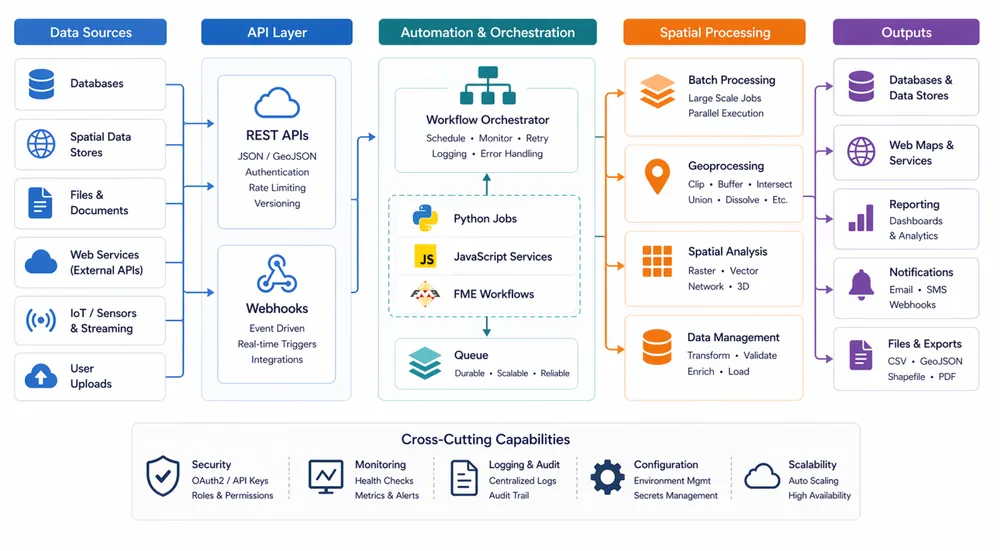
We design and implement web services, APIs, and automation workflows for organisations that need their systems to exchange data reliably and their teams to spend less time on repetitive processing. These services often sit between databases, spatial platforms, third-party systems, reporting tools, and front-end applications, providing a stable layer for integration, orchestration, and business logic.
Our automation work covers tasks such as large-scale map production, batch geocoding and reverse geocoding, route and matrix processing, reporting, data extraction, web scraping, quality checks, and chained geoprocessing workflows. We use Python, JavaScript, FME, ArcGIS ModelBuilder, and a range of open-source geospatial libraries to build services that are tailored to the operational pattern, scale, and governance needs of each client.
Depending on the use case, we can deploy these capabilities as scheduled jobs, queue-based processing services, ArcGIS Enterprise geoprocessing services, or standalone REST APIs without ArcGIS Enterprise. We also design the supporting monitoring, error handling, documentation, and support processes so the automation is dependable in production rather than a one-off technical script.